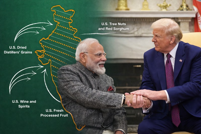
The now-deleted post had drawn widespread attention because the map matched India’s official cartographic position, showing the full territory as Indian.
Parts of the region are currently under the control of Pakistan and China, which claim them illegally according to New Delhi.
A departure from past US practice
The graphic was shared on February 7 as part of the announcement of the bilateral interim trade framework between Washington and New Delhi.
It illustrated India’s tariff reductions on American exports and was accompanied by a map of India that did not mark PoK or Aksai Chin as disputed areas.
Historically, maps circulated by US government agencies have shown these territories with boundary demarcations indicating their disputed status.
The absence of such markings in the USTR post marked a notable shift from long-standing American cartographic practice.
This deviation quickly sparked debate among policy observers and strategic analysts.
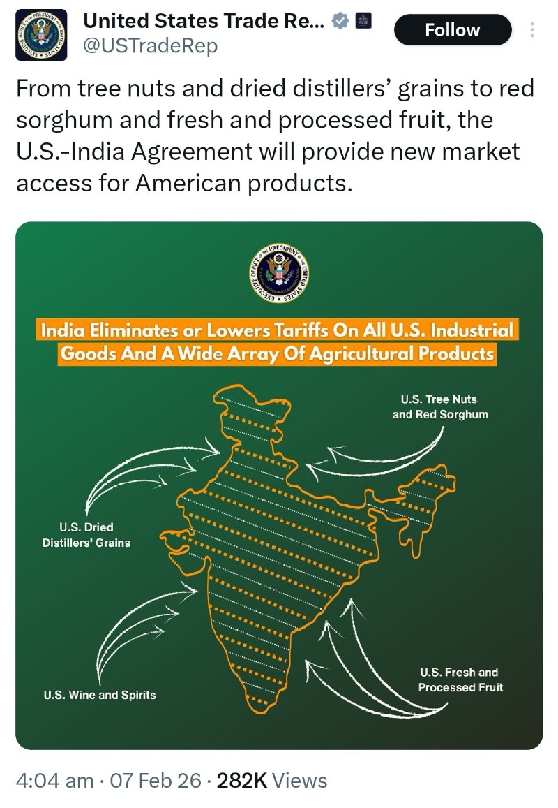 The US trade office on Feb 7 posted the map on X, showing PoK and Aksai Chin as Indian territory. Photo: Screen-grab from X
Geopolitical signals or oversight?
Some experts interpreted the map as a deliberate geopolitical gesture toward India, particularly at a time when Washington’s relations with Pakistan and China remain strained.
Others suggested the depiction could have been an oversight in the design of the trade announcement graphic.
The development also came amid signs that strategic alignment between India and the United States — especially in the Indo-Pacific — had regained momentum after earlier trade tensions.
However, by removing the post entirely from its official X account, the USTR appears to have sought to end the speculation surrounding the map’s depiction.
India’s consistent position
India has consistently maintained that the entire Union Territory of Jammu and Kashmir and Ladakh, including areas currently under Pakistani and Chinese control, “has been, is and will always be an integral and inalienable part of India.”
New Delhi’s official maps reflect this claim, and Aksai Chin is regarded by India as sovereign territory despite being under Chinese administration.
The brief appearance of a US government graphic mirroring India’s official map carried diplomatic weight, even though it has now been withdrawn.
What this removal signals
While the USTR has not issued a public explanation for removing the post, the episode highlights the sensitivity surrounding territorial depictions in international diplomacy.
Cartographic representations by major powers often carry symbolic and political significance far beyond design choices.
For now, the deletion has closed one chapter of the debate, but it underscores how even a map embedded in a trade announcement can trigger wider geopolitical interpretations in an already complex regional landscape.